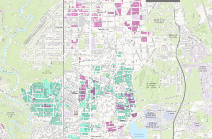
Last year I wrote about a fascinating talk at the Mt. Pleasant Library: historians and researchers had been working to understand historic residential segregation in the city. In many places (including DC) real estate developers, bankers and sometimes the government enforced racial segregation by not selling to minorities in some areas, or by only selling to minorities in others. This was called redlining, as in the lines drawn on the map to determine who could live where.
There were also other methods such as “covenants” and deeds placed on houses that would not allow the owners to sell to minority groups. Often this meant that front buyers would be involved, so African Americans could get around the covenants and buy where they wanted. (See above for a screenshot of an interactive map of some of those restrictive covenants and deeds.)
Eventually these practices were outlawed, but the legacy of them still exists. And since that presentation in the summer, the historians working on the project have learned a lot more. There’s a talk tonight by them talking about what they’ve learned, including maps, documents and more. Should be fascinating. The historians also published a “story map” about what they learned, which is worth reading.
How real estate developers shaped the racial landscape of Ward 4
Thursday, April 14, 7 pm – Petworth Library, Georgia Avenue & Upshur Street, NW
Mapping Segregation in Washington DC is a public history project documenting the historic segregation of DC’s housing and schools, playgrounds, and other public spaces.Last summer we unveiled our first story map, which highlights DC’s central role in the struggle to abolish restricted housing nationwide and shows how the city’s racial geography was shaped by segregation. See prologuedc.com/blog/mapping-segregation.
Come and find out what we’ve been doing since then. Learn how restricted housing shaped neighborhoods in Ward 4. Maps tell stories words cannot!
Mapping Segregation in Washington DC was launched in 2014 by Prologue DC in collaboration with GIS specialist Brian Kraft of JMT Technology Group. It has been funded in part by the DC Preservation League and Humanities DC.


