This is fun: DCist writes about a tool developed by coder Shannon Turner that lets you create your own Metro system — maybe you want to add some stations, make a new line, or completely redesign it.
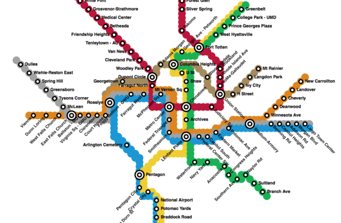
It took a minute to get the hang of (you have to draw the lines first, then add stations on top) but I spent some time goofing around and having fun. I made a new line that runs across town through Columbia Heights, since it can be a pain to go east-west from our area using transit.
My dream line runs from Mt. Rainier in Maryland to Langdon Park (mainly so I can go to Public Option, an awesome brewery, and the cool shops on Rhode Island Ave NE) then to Ivy City, H Street, Union Station, a new Bloomingdale station, to Columbia Heights, then actual Adams Morgan (18th and Columbia) and then on to Dupont and Georgetown, ending in Rosslyn. I suppose you could send it into central Arlington and beyond but I don’t know much about that area.
Of course, it’s purely theoretical as I assume this would be pretty expensive and difficult, especially making new transfer stations at Union Station, Columbia Heights and Dupont — but hey, we can dream, right?
I also added a few other little things, like an extension of the Yellow line across the river to National Harbor and an infill station at Potomac Yards. I thought about an extra DC United stadium station but couldn’t think of a good way to get there.
Give it a shot, and let us know what you did. Maybe more stations in NE and Prince George’s County?


